
- Start >
- Rivers >
- Waterlevel >
- Regnitz >
- Postmünster >
- Chart of year

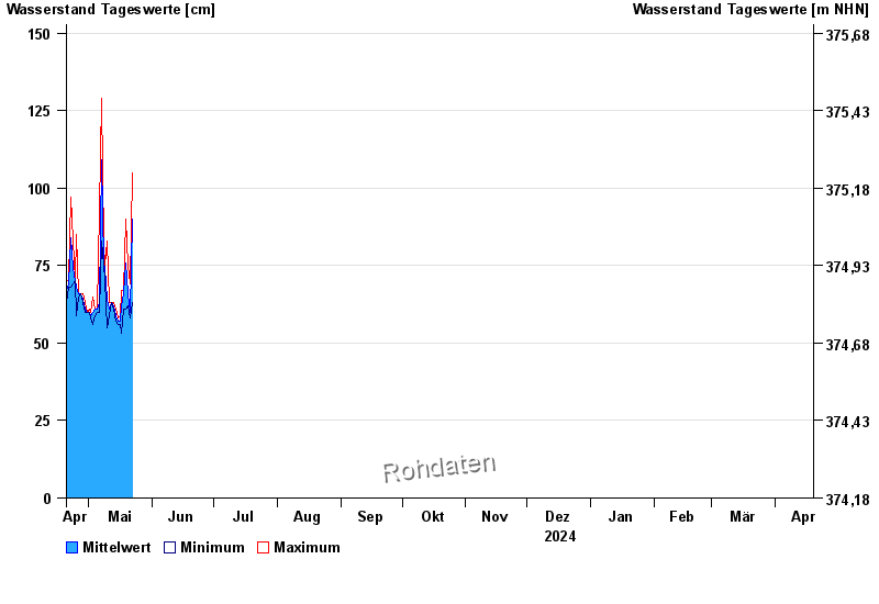
Chart of year Postmünster / Rott
Waterlevel from 20.04.2024 to 19.04.2025
- 02.08.1991 Wasserstand: 388 cm
- 03.06.2013 Wasserstand: 373 cm
- 03.03.1987 Wasserstand: 336 cm
- 13.01.2011 Wasserstand: 317 cm
- 20.02.1999 Wasserstand: 306 cm
| Date | Mean value [cm] | Maximum [cm] | Minimum [cm] |
|---|---|---|---|
| 22.05.2024 | 87 | 104 | 63 |
| 21.05.2024 | 60 | 69 | 58 |
| 20.05.2024 | 66 | 75 | 62 |
| 19.05.2024 | 76 | 90 | 61 |
| 18.05.2024 | 66 | 67 | 61 |
| 17.05.2024 | 62 | 67 | 53 |
| 16.05.2024 | 57 | 59 | 56 |
© Bayerisches Landesamt für Umwelt 2024