
- Start >
- Rivers >
- Waterlevel >
- Regnitz >
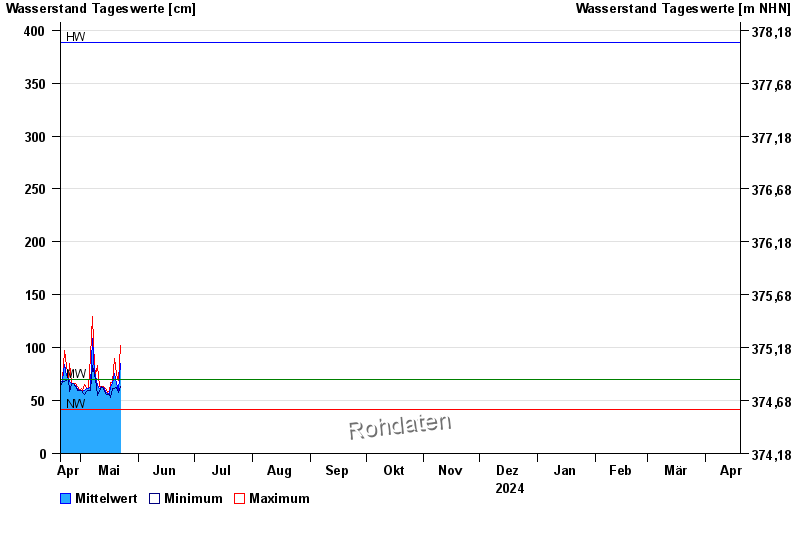
- Postmünster >
- Chart of year

Chart of year Postmünster / Rott
Waterlevel from 20.04.2024 to 19.04.2025
| Date | Mean value [cm] | Maximum [cm] | Minimum [cm] |
|---|---|---|---|
| 03.06.2024 | 138 | 169 | 108 |
| 02.06.2024 | 182 | 196 | 154 |
| 01.06.2024 | 172 | 198 | 142 |
| 31.05.2024 | 122 | 171 | 92 |
| 30.05.2024 | 79 | 99 | 72 |
| 29.05.2024 | 86 | 105 | 75 |
| 28.05.2024 | 91 | 106 | 63 |
© Bayerisches Landesamt für Umwelt 2024