
- Start >
- Rivers >
- Waterlevel >
- Regnitz >
- Pettstadt >
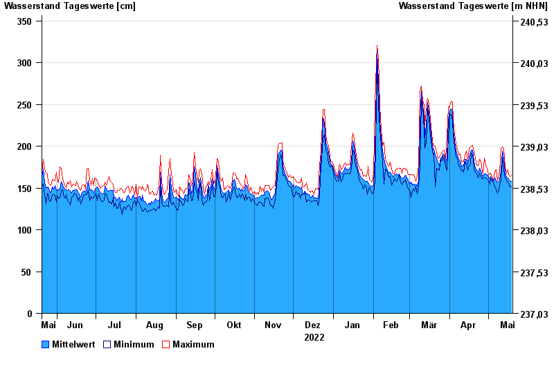
- Chart of year

Chart of year Pettstadt / Regnitz
Waterlevel from 20.05.2022 to 19.05.2023
- 09.01.2011 Wasserstand: 593 cm
- 02.06.2013 Wasserstand: 505 cm
- 10.12.2010 Wasserstand: 444 cm
- 11.03.2006 Wasserstand: 417 cm
- 16.01.2011 Wasserstand: 404 cm
| Date | Mean value [cm] | Maximum [cm] | Minimum [cm] |
|---|---|---|---|
| 19.05.2023 | 158 | 165 | 151 |
| 18.05.2023 | 159 | 164 | 151 |
| 17.05.2023 | 160 | 166 | 155 |
| 16.05.2023 | 162 | 172 | 157 |
| 15.05.2023 | 163 | 168 | 159 |
| 14.05.2023 | 169 | 175 | 162 |
| 13.05.2023 | 185 | 197 | 171 |
© Bayerisches Landesamt für Umwelt 2024