
- Start >
- Rivers >
- Waterlevel >
- Regnitz >
- Neu Ulm, Bad Held >
- Chart of month

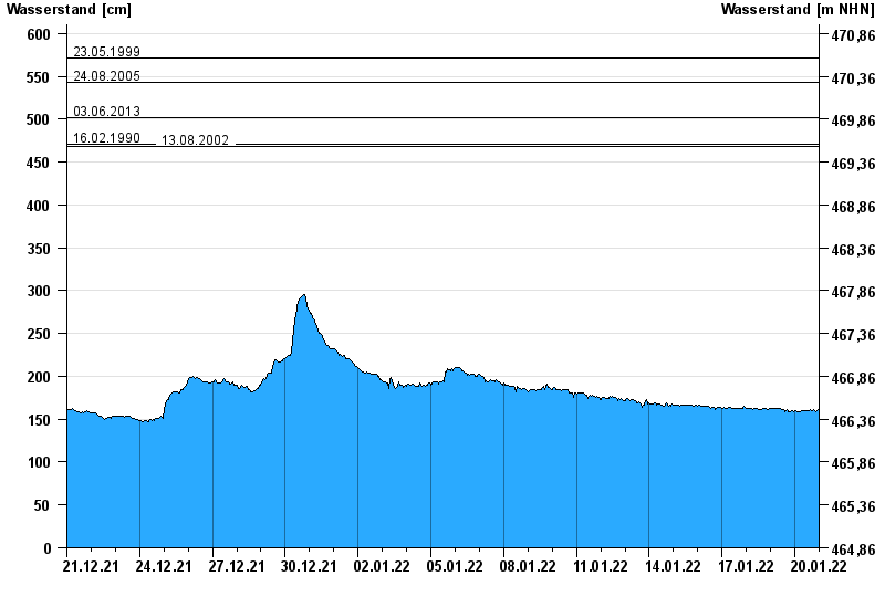
Chart of month Neu Ulm, Bad Held / Donau
Waterlevel from 21.12.2021 to 20.01.2022
ACHTUNG!
Pegel durch außerordentlichen Kraftwerksbetrieb beeinflusst.
- 23.05.1999 Wasserstand: 571 cm
- 24.08.2005 Wasserstand: 543 cm
- 03.06.2013 Wasserstand: 502 cm
- 16.02.1990 Wasserstand: 471 cm
- 13.08.2002 Wasserstand: 469 cm
| Date | Waterlevel [cm] |
|---|---|
| 20.01.2022 23:45 | 160 |
| 20.01.2022 23:30 | 160 |
| 20.01.2022 23:15 | 160 |
| 20.01.2022 23:00 | 160 |
| 20.01.2022 22:45 | 160 |
| 20.01.2022 22:30 | 161 |
| 20.01.2022 22:15 | 160 |
© Bayerisches Landesamt für Umwelt 2024