
- Start >
- Rivers >
- Waterlevel >
- Regnitz >
- Mettendorf >
- Chart of month

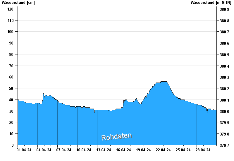
Chart of month Mettendorf / Schwarzach
Waterlevel from 01.04.2024 to 30.04.2024
- 03.03.1987 Wasserstand: 318 cm
- 31.01.1982 Wasserstand: 314 cm
- 09.05.1978 Wasserstand: 311 cm
- 08.12.1974 Wasserstand: 308 cm
- 13.04.1994 Wasserstand: 306 cm
| Date | Waterlevel [cm] |
|---|---|
| 30.04.2024 02:00 | 32 |
| 30.04.2024 01:45 | 32 |
| 30.04.2024 01:30 | 32 |
| 30.04.2024 01:15 | 32 |
| 30.04.2024 01:00 | 32 |
| 30.04.2024 00:45 | 32 |
| 30.04.2024 00:30 | 32 |
© Bayerisches Landesamt für Umwelt 2024