
- Start >
- Rivers >
- Waterlevel >
- Regnitz >
- Laufermühle >
- Chart of month

Chart of month Laufermühle / Aisch
Waterlevel from 03.01.2023 to 02.02.2023
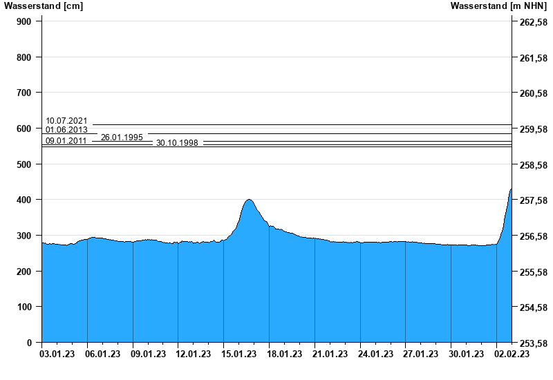
- 10.07.2021 Wasserstand: 609 cm
- 01.06.2013 Wasserstand: 584 cm
- 26.01.1995 Wasserstand: 563 cm
- 09.01.2011 Wasserstand: 553 cm
- 30.10.1998 Wasserstand: 548 cm
| Date | Waterlevel [cm] |
|---|---|
| 02.02.2023 23:45 | 432 |
| 02.02.2023 23:30 | 431 |
| 02.02.2023 23:15 | 430 |
| 02.02.2023 23:00 | 430 |
| 02.02.2023 22:45 | 429 |
| 02.02.2023 22:30 | 428 |
| 02.02.2023 22:15 | 427 |
© Bayerisches Landesamt für Umwelt 2025