
- Start >
- Rivers >
- Waterlevel >
- Regnitz >
- Hollfeld >
- Chart of month

Chart of month Hollfeld / Wiesent
Waterlevel from 01.05.2024 to 01.05.2024
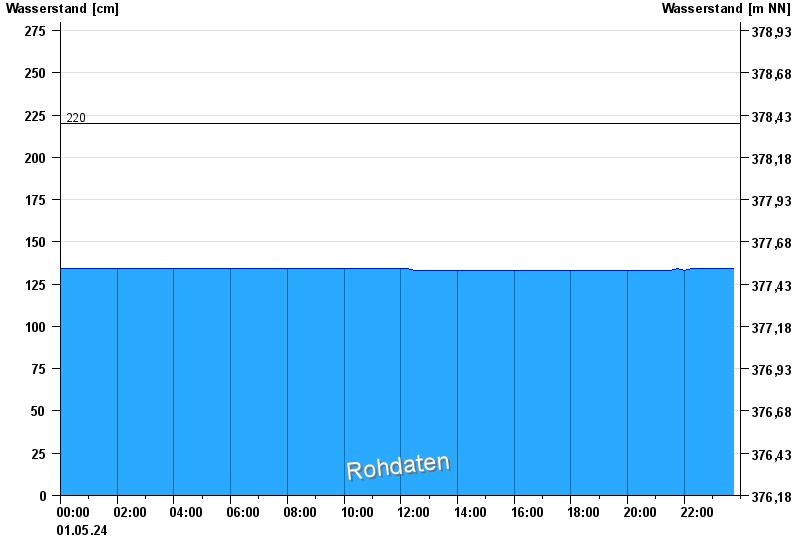
- 220 cm: Hollfeld: Linksseitige Ausuferung in das Wiesengelände unterhalb des Pegels.
| Date | Waterlevel [cm] |
|---|---|
| 02.05.2024 00:30 | 134 |
| 02.05.2024 00:15 | 134 |
| 02.05.2024 00:00 | 134 |
| 01.05.2024 23:45 | 134 |
| 01.05.2024 23:30 | 134 |
| 01.05.2024 23:15 | 134 |
| 01.05.2024 23:00 | 134 |
© Bayerisches Landesamt für Umwelt 2024