
- Start >
- Rivers >
- Waterlevel >
- Regnitz >
- Frauenaurach >
- Chart of year

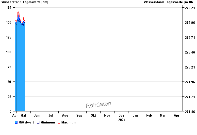
Chart of year Frauenaurach / Aurach
Waterlevel from 28.04.2024 to 27.04.2025
- Hochwassergefahrenfläche HQhäufig 390 cm
- Hochwassergefahrenfläche HQ100 430 cm
| Date | Mean value [cm] | Maximum [cm] | Minimum [cm] |
|---|---|---|---|
| 09.05.2024 | 154 | 154 | 154 |
| 08.05.2024 | 155 | 160 | 150 |
| 07.05.2024 | 160 | 166 | 157 |
| 06.05.2024 | 162 | 168 | 153 |
| 05.05.2024 | 153 | 160 | 149 |
| 04.05.2024 | 154 | 159 | 153 |
| 03.05.2024 | 160 | 170 | 154 |
© Bayerisches Landesamt für Umwelt 2024