
- Start >
- Rivers >
- Waterlevel >
- Regnitz >
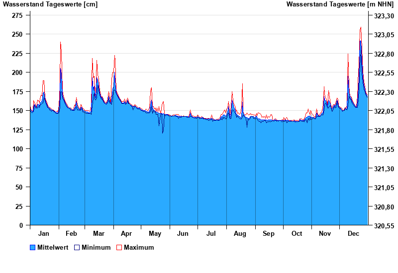
- Behringersmühle >
- Chart of year

Chart of year Behringersmühle / Wiesent
Waterlevel from 01.01.2023 to 31.12.2023
- 13.01.2011 Wasserstand: 290 cm
- 03.06.2013 Wasserstand: 279 cm
- 27.08.2010 Wasserstand: 278 cm
- 23.12.2012 Wasserstand: 276 cm
- 28.05.2006 Wasserstand: 273 cm
| Date | Mean value [cm] | Maximum [cm] | Minimum [cm] |
|---|---|---|---|
| 31.12.2023 | 169 | 171 | 167 |
| 30.12.2023 | 171 | 172 | 169 |
| 29.12.2023 | 174 | 176 | 172 |
| 28.12.2023 | 178 | 181 | 175 |
| 27.12.2023 | 183 | 188 | 178 |
| 26.12.2023 | 193 | 200 | 187 |
| 25.12.2023 | 215 | 231 | 199 |
© Bayerisches Landesamt für Umwelt 2024