
- Start >
- Rivers >
- Waterlevel >
- Regnitz >
- Behringersmühle >
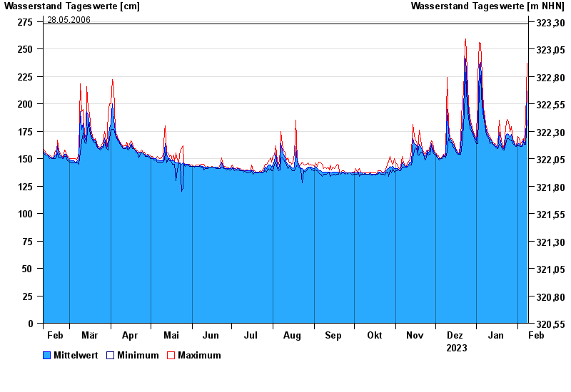
- Chart of year

Chart of year Behringersmühle / Wiesent
Waterlevel from 09.02.2023 to 08.02.2024
- 13.01.2011 Wasserstand: 290 cm
- 03.06.2013 Wasserstand: 279 cm
- 27.08.2010 Wasserstand: 278 cm
- 23.12.2012 Wasserstand: 276 cm
- 28.05.2006 Wasserstand: 273 cm
| Date | Mean value [cm] | Maximum [cm] | Minimum [cm] |
|---|---|---|---|
| 08.02.2024 | 212 | 237 | 185 |
| 07.02.2024 | 166 | 185 | 163 |
| 06.02.2024 | 164 | 166 | 163 |
| 05.02.2024 | 167 | 168 | 165 |
| 04.02.2024 | 162 | 166 | 161 |
| 03.02.2024 | 162 | 163 | 161 |
| 02.02.2024 | 164 | 168 | 162 |
© Bayerisches Landesamt für Umwelt 2024