
- Start >
- Rivers >
- Waterlevel >
- Regnitz >
- Atzhausen >
- Chart of month

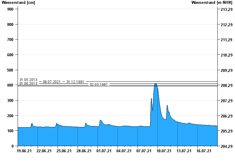
Chart of month Atzhausen / Castellbach
Waterlevel from 19.06.2021 to 18.07.2021
note
Messwerte ab 02.06. ca. 6.30 Uhr nicht korrekt. Geber 2 (Redundanz) ausgefallen.
- 31.05.2013 Wasserstand: 423 cm
- 09.07.2021 Wasserstand: 410 cm
- 31.12.1981 Wasserstand: 410 cm
- 01.06.2013 Wasserstand: 398 cm
- 02.03.1987 Wasserstand: 392 cm
| Date | Waterlevel [cm] |
|---|---|
| 19.07.2021 00:45 | 131 |
| 19.07.2021 00:30 | 131 |
| 19.07.2021 00:15 | 131 |
| 19.07.2021 00:00 | 131 |
| 18.07.2021 23:45 | 131 |
| 18.07.2021 23:30 | 131 |
| 18.07.2021 23:15 | 131 |
© Bayerisches Landesamt für Umwelt 2024