
- Start >
- Rivers >
- Waterlevel >
- Regnitz >
- Aeschach >
- Chart of year

Chart of year Aeschach / Oberreitnauer Ach
Waterlevel from 20.04.2024 to 19.04.2025
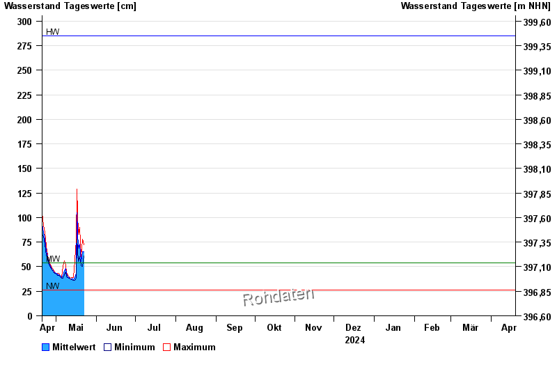
| Date | Mean value [cm] | Maximum [cm] | Minimum [cm] |
|---|---|---|---|
| 16.06.2024 | 52 | 54 | 51 |
| 15.06.2024 | 56 | 62 | 51 |
| 14.06.2024 | 54 | 55 | 52 |
| 13.06.2024 | 58 | 60 | 54 |
| 12.06.2024 | 64 | 69 | 59 |
| 11.06.2024 | 76 | 85 | 69 |
| 10.06.2024 | 108 | 131 | 85 |
© Bayerisches Landesamt für Umwelt 2024