
- Start >
- Rivers >
- Waterlevel >
- Untere Donau >
- Wallersdorf >
- Chart of month

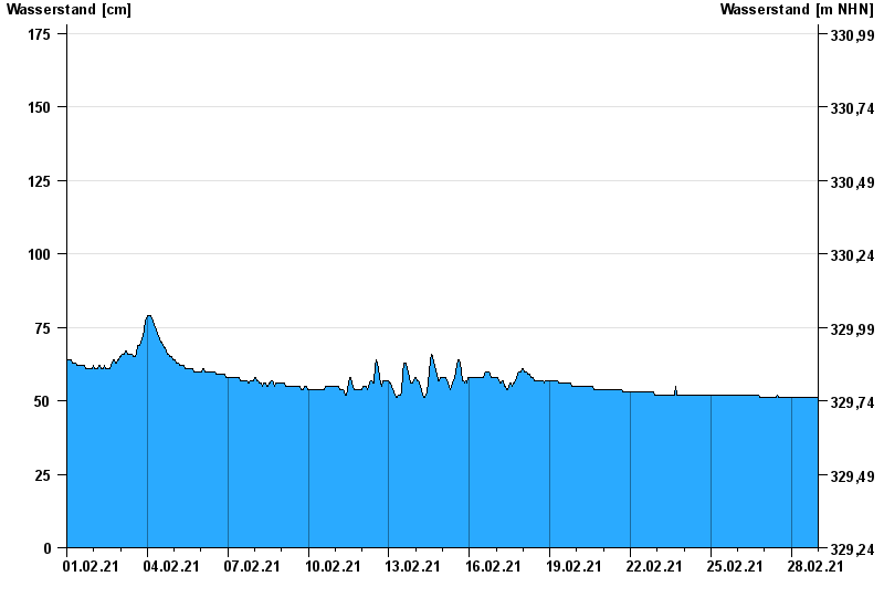
Chart of month Wallersdorf / Reißingerbach
Waterlevel from 01.02.2021 to 28.02.2021
- 14.01.2011 Wasserstand: 221 cm
- 03.06.2013 Wasserstand: 212 cm
- 16.02.2006 Wasserstand: 205 cm
- 04.08.1991 Wasserstand: 202 cm
- 11.11.2002 Wasserstand: 198 cm
| Date | Waterlevel [cm] |
|---|---|
| 28.02.2021 23:45 | 51 |
| 28.02.2021 23:30 | 51 |
| 28.02.2021 23:15 | 51 |
| 28.02.2021 23:00 | 51 |
| 28.02.2021 22:45 | 51 |
| 28.02.2021 22:30 | 51 |
| 28.02.2021 22:15 | 51 |
© Bayerisches Landesamt für Umwelt 2024