
- Start >
- Rivers >
- Waterlevel >
- Untere Donau >
- Unterkashof >
- Current values

Current values Unterkashof / Reschwasser
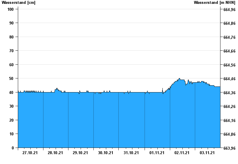
Waterlevel from 27.10.2021 to 03.11.2021
- 21.03.2002 Wasserstand: 218 cm
- 21.12.1993 Wasserstand: 169 cm
- 26.06.2016 Wasserstand: 155 cm
- 12.06.2018 Wasserstand: 154 cm
- 01.03.2008 Wasserstand: 153 cm
| Date | Waterlevel [cm] |
|---|---|
| 03.11.2021 23:45 | 44 |
| 03.11.2021 23:30 | 44 |
| 03.11.2021 23:15 | 44 |
| 03.11.2021 23:00 | 44 |
| 03.11.2021 22:45 | 44 |
| 03.11.2021 22:30 | 44 |
| 03.11.2021 22:15 | 44 |
© Bayerisches Landesamt für Umwelt 2024