
- Start >
- Rivers >
- Waterlevel >
- Untere Donau >
- Teisnach >
- Chart of month

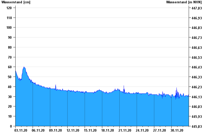
Chart of month Teisnach / Schwarzer Regen
Waterlevel from 03.11.2020 to 02.12.2020
- 150 cm: Teisnach: Überflutung der Vorländer unterstrom von Teisnach
| Date | Waterlevel [cm] |
|---|---|
| 02.12.2020 23:45 | 31 |
| 02.12.2020 23:30 | 31 |
| 02.12.2020 23:15 | 31 |
| 02.12.2020 23:00 | 32 |
| 02.12.2020 22:45 | 32 |
| 02.12.2020 22:30 | 31 |
| 02.12.2020 22:15 | 31 |
© Bayerisches Landesamt für Umwelt 2024