
- Start >
- Rivers >
- Waterlevel >
- Untere Donau >
- Taferlruck >
- Chart of year

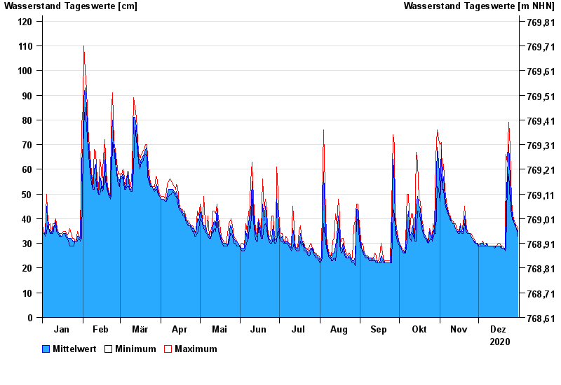
Chart of year Taferlruck / Große Ohe
Waterlevel from 01.01.2020 to 31.12.2020
- 12.08.2002 Wasserstand: 165 cm
- 21.03.2002 Wasserstand: 153 cm
- 22.07.1980 Wasserstand: 144 cm
- 21.12.1993 Wasserstand: 138 cm
- 19.12.1987 Wasserstand: 131 cm
| Date | Mean value [cm] | Maximum [cm] | Minimum [cm] |
|---|---|---|---|
| 31.12.2020 | 35 | 36 | 33 |
| 30.12.2020 | 36 | 37 | 36 |
| 29.12.2020 | 38 | 38 | 37 |
| 28.12.2020 | 38 | 39 | 38 |
| 27.12.2020 | 40 | 41 | 39 |
| 26.12.2020 | 44 | 47 | 41 |
| 25.12.2020 | 56 | 69 | 47 |
© Bayerisches Landesamt für Umwelt 2024