
- Start >
- Rivers >
- Waterlevel >
- Untere Donau >
- Taferlruck >
- Chart of month

Chart of month Taferlruck / Große Ohe
Waterlevel from 01.07.2022 to 31.07.2022
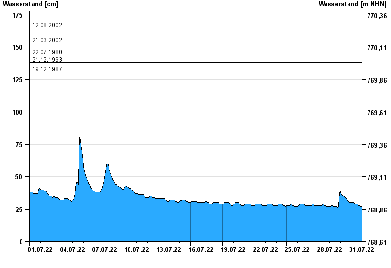
- 12.08.2002 Wasserstand: 165 cm
- 21.03.2002 Wasserstand: 153 cm
- 22.07.1980 Wasserstand: 144 cm
- 21.12.1993 Wasserstand: 138 cm
- 19.12.1987 Wasserstand: 131 cm
| Date | Waterlevel [cm] |
|---|---|
| 01.08.2022 00:45 | 28 |
| 01.08.2022 00:30 | 27 |
| 01.08.2022 00:15 | 27 |
| 01.08.2022 00:00 | 27 |
| 31.07.2022 23:45 | 27 |
| 31.07.2022 23:30 | 27 |
| 31.07.2022 23:15 | 27 |
© Bayerisches Landesamt für Umwelt 2024