
- Start >
- Rivers >
- Waterlevel >
- Untere Donau >
- Straubing >
- Chart of year

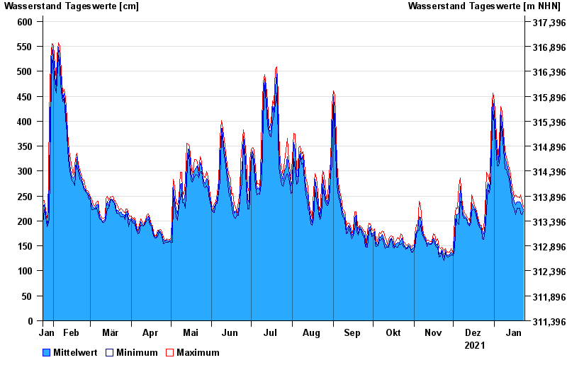
Chart of year Straubing / Donau
Waterlevel from 24.01.2021 to 23.01.2022
- 05.06.2013 Wasserstand: 795 cm
- 14.08.2002 Wasserstand: 749 cm
- 28.03.1988 Wasserstand: 702 cm
- 16.01.2011 Wasserstand: 699 cm
- 25.05.1999 Wasserstand: 686 cm
| Date | Mean value [cm] | Maximum [cm] | Minimum [cm] |
|---|---|---|---|
| 23.01.2022 | 223 | 228 | 219 |
| 22.01.2022 | 229 | 239 | 213 |
| 21.01.2022 | 235 | 253 | 216 |
| 20.01.2022 | 238 | 246 | 226 |
| 19.01.2022 | 238 | 248 | 226 |
| 18.01.2022 | 238 | 248 | 225 |
| 17.01.2022 | 233 | 253 | 213 |
© Bayerisches Landesamt für Umwelt 2024