
- Start >
- Rivers >
- Waterlevel >
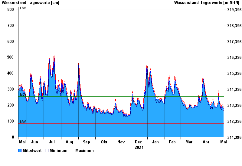
- Untere Donau >
- Straubing >
- Chart of year

Chart of year Straubing / Donau
Waterlevel from 17.05.2021 to 16.05.2022
| Date | Mean value [cm] | Maximum [cm] | Minimum [cm] |
|---|---|---|---|
| 16.05.2022 | 175 | 186 | 165 |
| 15.05.2022 | 195 | 205 | 185 |
| 14.05.2022 | 192 | 204 | 188 |
| 13.05.2022 | 191 | 204 | 174 |
| 12.05.2022 | 175 | 183 | 169 |
| 11.05.2022 | 185 | 191 | 180 |
| 10.05.2022 | 196 | 215 | 189 |
© Bayerisches Landesamt für Umwelt 2024