
- Start >
- Rivers >
- Waterlevel >
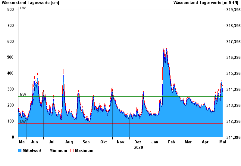
- Untere Donau >
- Straubing >
- Chart of year

Chart of year Straubing / Donau
Waterlevel from 17.05.2020 to 16.05.2021
| Date | Mean value [cm] | Maximum [cm] | Minimum [cm] |
|---|---|---|---|
| 16.05.2021 | 295 | 319 | 282 |
| 15.05.2021 | 339 | 348 | 319 |
| 14.05.2021 | 345 | 354 | 338 |
| 13.05.2021 | 313 | 356 | 281 |
| 12.05.2021 | 254 | 281 | 226 |
| 11.05.2021 | 242 | 253 | 237 |
| 10.05.2021 | 244 | 258 | 237 |
© Bayerisches Landesamt für Umwelt 2024