
- Start >
- Rivers >
- Waterlevel >
- Untere Donau >
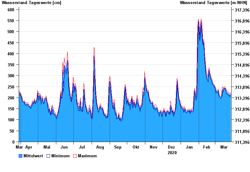
- Straubing >
- Chart of year

Chart of year Straubing / Donau
Waterlevel from 29.03.2020 to 28.03.2021
- 05.06.2013 Wasserstand: 795 cm
- 14.08.2002 Wasserstand: 749 cm
- 28.03.1988 Wasserstand: 702 cm
- 16.01.2011 Wasserstand: 699 cm
- 25.05.1999 Wasserstand: 686 cm
| Date | Mean value [cm] | Maximum [cm] | Minimum [cm] |
|---|---|---|---|
| 28.03.2021 | 217 | 224 | 213 |
| 27.03.2021 | 208 | 217 | 202 |
| 26.03.2021 | 212 | 218 | 208 |
| 25.03.2021 | 212 | 223 | 208 |
| 24.03.2021 | 218 | 225 | 209 |
| 23.03.2021 | 216 | 221 | 213 |
| 22.03.2021 | 221 | 228 | 215 |
© Bayerisches Landesamt für Umwelt 2024