
- Start >
- Rivers >
- Waterlevel >
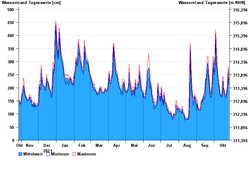
- Untere Donau >
- Straubing >
- Chart of year

Chart of year Straubing / Donau
Waterlevel from 28.10.2021 to 27.10.2022
- 05.06.2013 Wasserstand: 795 cm
- 14.08.2002 Wasserstand: 749 cm
- 28.03.1988 Wasserstand: 702 cm
- 16.01.2011 Wasserstand: 699 cm
- 25.05.1999 Wasserstand: 686 cm
| Date | Mean value [cm] | Maximum [cm] | Minimum [cm] |
|---|---|---|---|
| 27.10.2022 | 229 | 250 | 216 |
| 26.10.2022 | 264 | 282 | 243 |
| 25.10.2022 | 217 | 251 | 197 |
| 24.10.2022 | 200 | 207 | 192 |
| 23.10.2022 | 185 | 201 | 172 |
| 22.10.2022 | 166 | 174 | 162 |
| 21.10.2022 | 166 | 170 | 164 |
© Bayerisches Landesamt für Umwelt 2024