
- Start >
- Rivers >
- Waterlevel >
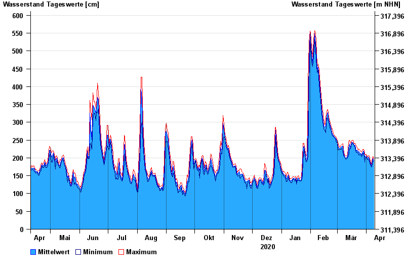
- Untere Donau >
- Straubing >
- Chart of year

Chart of year Straubing / Donau
Waterlevel from 10.04.2020 to 09.04.2021
- 05.06.2013 Wasserstand: 795 cm
- 14.08.2002 Wasserstand: 749 cm
- 28.03.1988 Wasserstand: 702 cm
- 16.01.2011 Wasserstand: 699 cm
- 25.05.1999 Wasserstand: 686 cm
| Date | Mean value [cm] | Maximum [cm] | Minimum [cm] |
|---|---|---|---|
| 09.04.2021 | 194 | 199 | 192 |
| 08.04.2021 | 199 | 204 | 191 |
| 07.04.2021 | 186 | 192 | 176 |
| 06.04.2021 | 178 | 181 | 174 |
| 05.04.2021 | 185 | 191 | 180 |
| 04.04.2021 | 199 | 205 | 191 |
| 03.04.2021 | 203 | 207 | 196 |
© Bayerisches Landesamt für Umwelt 2024