
- Start >
- Rivers >
- Waterlevel >
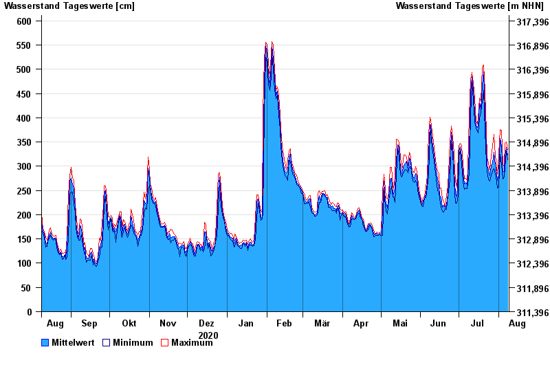
- Untere Donau >
- Straubing >
- Chart of year

Chart of year Straubing / Donau
Waterlevel from 09.08.2020 to 08.08.2021
- 05.06.2013 Wasserstand: 795 cm
- 14.08.2002 Wasserstand: 749 cm
- 28.03.1988 Wasserstand: 702 cm
- 16.01.2011 Wasserstand: 699 cm
- 25.05.1999 Wasserstand: 686 cm
| Date | Mean value [cm] | Maximum [cm] | Minimum [cm] |
|---|---|---|---|
| 08.08.2021 | 323 | 334 | 313 |
| 07.08.2021 | 339 | 350 | 330 |
| 06.08.2021 | 320 | 347 | 298 |
| 05.08.2021 | 289 | 302 | 278 |
| 04.08.2021 | 289 | 304 | 273 |
| 03.08.2021 | 340 | 374 | 304 |
| 02.08.2021 | 357 | 376 | 325 |
© Bayerisches Landesamt für Umwelt 2024