
- Start >
- Rivers >
- Waterlevel >
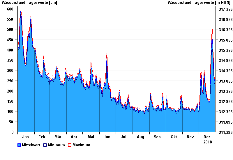
- Untere Donau >
- Straubing >
- Chart of year

Chart of year Straubing / Donau
Waterlevel from 01.01.2018 to 31.12.2018
- 05.06.2013 Wasserstand: 795 cm
- 14.08.2002 Wasserstand: 749 cm
- 28.03.1988 Wasserstand: 702 cm
- 16.01.2011 Wasserstand: 699 cm
- 25.05.1999 Wasserstand: 686 cm
| Date | Mean value [cm] | Maximum [cm] | Minimum [cm] |
|---|---|---|---|
| 31.12.2018 | 238 | 245 | 229 |
| 30.12.2018 | 252 | 259 | 236 |
| 29.12.2018 | 274 | 294 | 252 |
| 28.12.2018 | 328 | 355 | 294 |
| 27.12.2018 | 372 | 402 | 354 |
| 26.12.2018 | 449 | 500 | 402 |
| 25.12.2018 | 465 | 500 | 411 |
© Bayerisches Landesamt für Umwelt 2024