
- Start >
- Rivers >
- Waterlevel >
- Untere Donau >
- Straubing >
- Chart of month

Chart of month Straubing / Donau
Waterlevel from 01.06.2021 to 01.07.2021
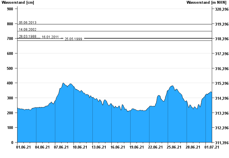
- 05.06.2013 Wasserstand: 795 cm
- 14.08.2002 Wasserstand: 749 cm
- 28.03.1988 Wasserstand: 702 cm
- 16.01.2011 Wasserstand: 699 cm
- 25.05.1999 Wasserstand: 686 cm
| Date | Waterlevel [cm] |
|---|---|
| 02.07.2021 00:45 | 334 |
| 02.07.2021 00:30 | 336 |
| 02.07.2021 00:15 | 334 |
| 02.07.2021 00:00 | 334 |
| 01.07.2021 23:45 | 335 |
| 01.07.2021 23:30 | 336 |
| 01.07.2021 23:15 | 336 |
© Bayerisches Landesamt für Umwelt 2024