
- Start >
- Rivers >
- Waterlevel >
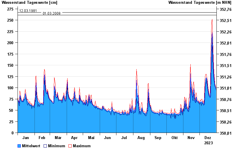
- Untere Donau >
- Schrottenbaummühle >
- Chart of year

Chart of year Schrottenbaummühle / Ilz
Waterlevel from 01.01.2023 to 31.12.2023
- 21.12.1993 Wasserstand: 328 cm
- 16.03.2019 Wasserstand: 296 cm
- 13.08.2002 Wasserstand: 288 cm
- 12.03.1981 Wasserstand: 267 cm
- 01.03.2008 Wasserstand: 261 cm
| Date | Mean value [cm] | Maximum [cm] | Minimum [cm] |
|---|---|---|---|
| 31.12.2023 | 98 | 101 | 95 |
| 30.12.2023 | 102 | 104 | 101 |
| 29.12.2023 | 107 | 110 | 104 |
| 28.12.2023 | 114 | 120 | 110 |
| 27.12.2023 | 126 | 134 | 116 |
| 26.12.2023 | 146 | 164 | 134 |
| 25.12.2023 | 188 | 204 | 164 |
© Bayerisches Landesamt für Umwelt 2024