
- Start >
- Rivers >
- Waterlevel >
- Untere Donau >
- Schrottenbaummühle >
- Chart of year

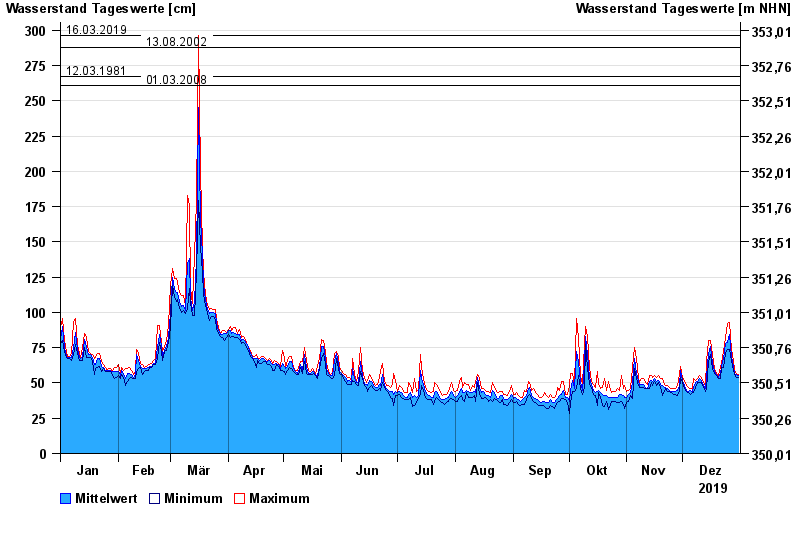
Chart of year Schrottenbaummühle / Ilz
Waterlevel from 01.01.2019 to 31.12.2019
- 21.12.1993 Wasserstand: 328 cm
- 16.03.2019 Wasserstand: 296 cm
- 13.08.2002 Wasserstand: 288 cm
- 12.03.1981 Wasserstand: 267 cm
- 01.03.2008 Wasserstand: 261 cm
| Date | Mean value [cm] | Maximum [cm] | Minimum [cm] |
|---|---|---|---|
| 31.12.2019 | 55 | 56 | 54 |
| 30.12.2019 | 56 | 57 | 54 |
| 29.12.2019 | 57 | 59 | 56 |
| 28.12.2019 | 62 | 66 | 59 |
| 27.12.2019 | 69 | 74 | 66 |
| 26.12.2019 | 84 | 93 | 74 |
| 25.12.2019 | 79 | 92 | 74 |
© Bayerisches Landesamt für Umwelt 2024