
- Start >
- Rivers >
- Waterlevel >
- Untere Donau >
- Schlehdorf >
- Chart of year

Chart of year Schlehdorf / Loisach
Waterlevel from 21.04.2024 to 20.04.2025
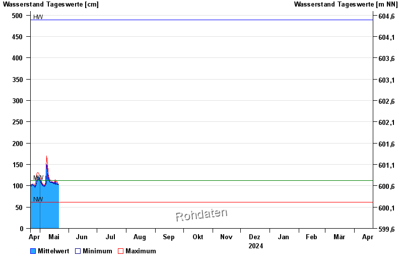
| Date | Mean value [cm] | Maximum [cm] | Minimum [cm] |
|---|---|---|---|
| 08.06.2024 | 147 | 148 | 145 |
| 07.06.2024 | 155 | 163 | 148 |
| 06.06.2024 | 170 | 182 | 160 |
| 05.06.2024 | 200 | 224 | 182 |
| 04.06.2024 | 261 | 289 | 224 |
| 03.06.2024 | 229 | 283 | 200 |
| 02.06.2024 | 234 | 267 | 202 |
© Bayerisches Landesamt für Umwelt 2024