
- Start >
- Rivers >
- Waterlevel >
- Untere Donau >
- Röhrnbach >
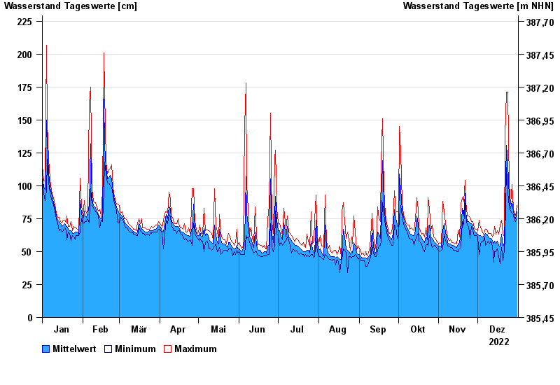
- Chart of year

Chart of year Röhrnbach / Osterbach
Waterlevel from 01.01.2022 to 31.12.2022
- 12.08.2002 Wasserstand: 264 cm
- 26.06.2016 Wasserstand: 261 cm
- 16.03.2019 Wasserstand: 250 cm
- 05.08.2010 Wasserstand: 239 cm
- 21.12.1993 Wasserstand: 236 cm
| Date | Mean value [cm] | Maximum [cm] | Minimum [cm] |
|---|---|---|---|
| 31.12.2022 | 80 | 85 | 75 |
| 30.12.2022 | 75 | 77 | 73 |
| 29.12.2022 | 78 | 79 | 74 |
| 28.12.2022 | 80 | 83 | 78 |
| 27.12.2022 | 88 | 101 | 79 |
| 26.12.2022 | 83 | 86 | 81 |
| 25.12.2022 | 91 | 101 | 84 |
© Bayerisches Landesamt für Umwelt 2024