
- Start >
- Rivers >
- Waterlevel >
- Untere Donau >
- Röhrnbach >
- Chart of year

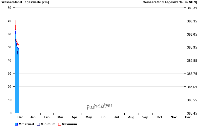
Chart of year Röhrnbach / Osterbach
Waterlevel from 08.12.2025 to 07.12.2026
- Hochwassergefahrenfläche HQ100 310 cm
| Date | Mean value [cm] | Maximum [cm] | Minimum [cm] |
|---|---|---|---|
| 16.12.2025 | 49 | 50 | 48 |
| 15.12.2025 | 49 | 51 | 48 |
| 14.12.2025 | 49 | 51 | 48 |
| 13.12.2025 | 50 | 54 | 44 |
| 12.12.2025 | 51 | 54 | 50 |
| 11.12.2025 | 53 | 54 | 52 |
| 10.12.2025 | 55 | 57 | 53 |
© Bayerisches Landesamt für Umwelt 2025