
- Start >
- Rivers >
- Waterlevel >
- Untere Donau >
- Röhrnbach >
- Chart of year

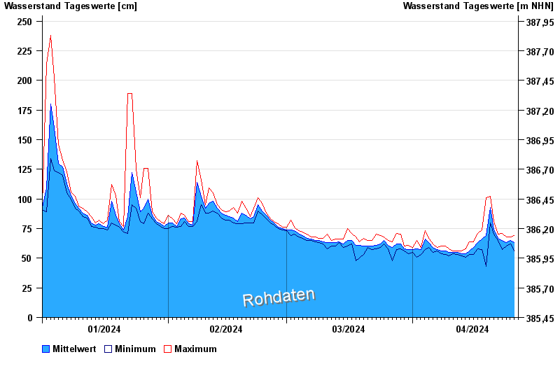
Chart of year Röhrnbach / Osterbach
Waterlevel from 01.01.2024 to 26.04.2024
- Hochwassergefahrenfläche HQ100 310 cm
| Date | Mean value [cm] | Maximum [cm] | Minimum [cm] |
|---|---|---|---|
| 26.04.2024 | 64 | 69 | 56 |
| 25.04.2024 | 65 | 68 | 62 |
| 24.04.2024 | 63 | 68 | 60 |
| 23.04.2024 | 65 | 71 | 57 |
| 22.04.2024 | 67 | 70 | 65 |
| 21.04.2024 | 74 | 81 | 70 |
| 20.04.2024 | 93 | 102 | 80 |
© Bayerisches Landesamt für Umwelt 2024