
- Start >
- Rivers >
- Waterlevel >
- Untere Donau >
- Röhrnbach >
- Chart of month

Chart of month Röhrnbach / Osterbach
Waterlevel from 21.12.2021 to 20.01.2022
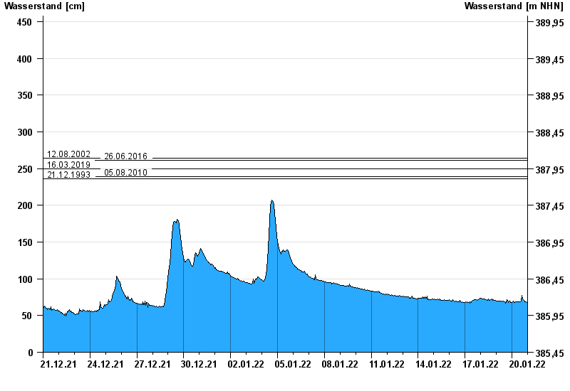
- 12.08.2002 Wasserstand: 264 cm
- 26.06.2016 Wasserstand: 261 cm
- 16.03.2019 Wasserstand: 250 cm
- 05.08.2010 Wasserstand: 239 cm
- 21.12.1993 Wasserstand: 236 cm
| Date | Waterlevel [cm] |
|---|---|
| 20.01.2022 23:45 | 68 |
| 20.01.2022 23:30 | 68 |
| 20.01.2022 23:15 | 68 |
| 20.01.2022 23:00 | 68 |
| 20.01.2022 22:45 | 68 |
| 20.01.2022 22:30 | 68 |
| 20.01.2022 22:15 | 68 |
© Bayerisches Landesamt für Umwelt 2024