
- Start >
- Rivers >
- Waterlevel >
- Untere Donau >
- Rachel-Diensthütte >
- Chart of total period

Chart of total period Rachel-Diensthütte / Markungsgraben
Waterlevel from 01.11.1988 to 04.05.2024
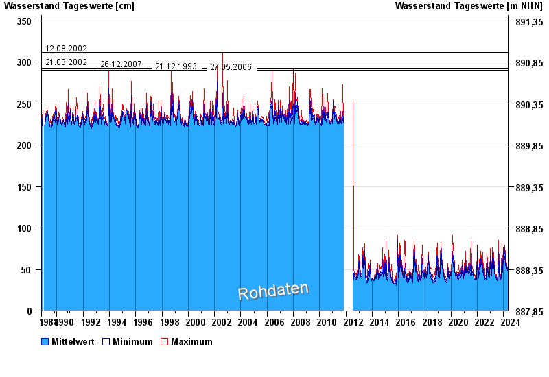
- 12.08.2002 Wasserstand: 312 cm
- 21.03.2002 Wasserstand: 295 cm
- 26.12.2007 Wasserstand: 293 cm
- 21.12.1993 Wasserstand: 290 cm
- 27.05.2006 Wasserstand: 289 cm
| Date | Mean value [cm] | Maximum [cm] | Minimum [cm] |
|---|---|---|---|
| 04.05.2024 | 43 | 43 | 43 |
| 03.05.2024 | 43 | 43 | 43 |
| 02.05.2024 | 43 | 43 | 42 |
| 01.05.2024 | 44 | 45 | 43 |
| 30.04.2024 | 46 | 47 | 45 |
| 29.04.2024 | 48 | 49 | 47 |
| 28.04.2024 | 46 | 49 | 45 |
© Bayerisches Landesamt für Umwelt 2024