
- Start >
- Rivers >
- Waterlevel >
- Untere Donau >
- Pulling >
- Chart of year

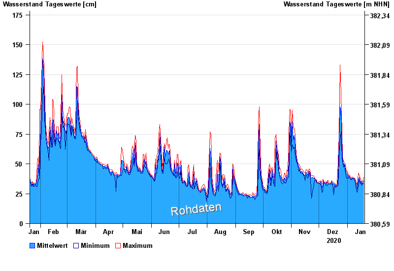
Chart of year Pulling / Regen
Waterlevel from 20.01.2020 to 19.01.2021
- 13.08.2002 Wasserstand: 437 cm
- 22.07.1980 Wasserstand: 374 cm
- 21.12.1993 Wasserstand: 358 cm
- 30.06.1966 Wasserstand: 340 cm
- 01.11.1998 Wasserstand: 327 cm
| Date | Mean value [cm] | Maximum [cm] | Minimum [cm] |
|---|---|---|---|
| 19.01.2021 | 36 | 39 | 33 |
| 18.01.2021 | 34 | 35 | 34 |
| 17.01.2021 | 34 | 35 | 32 |
| 16.01.2021 | 35 | 36 | 35 |
| 15.01.2021 | 35 | 38 | 33 |
| 14.01.2021 | 39 | 41 | 37 |
| 13.01.2021 | 37 | 42 | 32 |
© Bayerisches Landesamt für Umwelt 2024