
- Start >
- Rivers >
- Waterlevel >
- Untere Donau >
- Pulling >
- Chart of year

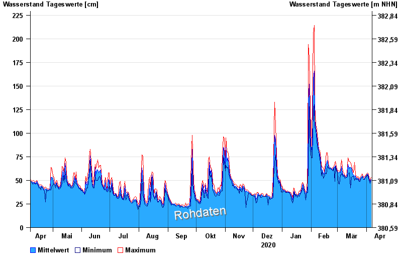
Chart of year Pulling / Regen
Waterlevel from 07.04.2020 to 06.04.2021
- 13.08.2002 Wasserstand: 437 cm
- 22.07.1980 Wasserstand: 374 cm
- 21.12.1993 Wasserstand: 358 cm
- 30.06.1966 Wasserstand: 340 cm
- 01.11.1998 Wasserstand: 327 cm
| Date | Mean value [cm] | Maximum [cm] | Minimum [cm] |
|---|---|---|---|
| 06.04.2021 | 51 | 53 | 50 |
| 05.04.2021 | 49 | 50 | 47 |
| 04.04.2021 | 51 | 52 | 50 |
| 03.04.2021 | 54 | 57 | 52 |
| 02.04.2021 | 57 | 58 | 56 |
| 01.04.2021 | 55 | 57 | 54 |
| 31.03.2021 | 54 | 55 | 53 |
© Bayerisches Landesamt für Umwelt 2024