
- Start >
- Rivers >
- Waterlevel >
- Untere Donau >
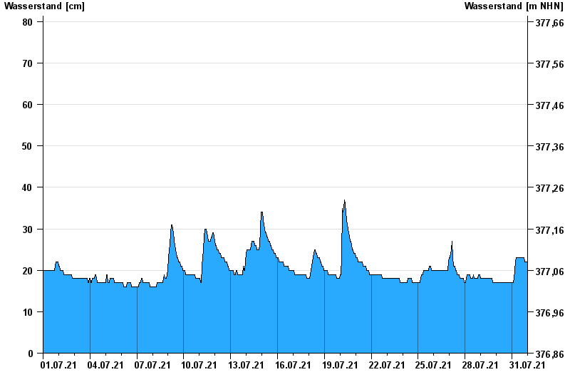
- Postmünster >
- Chart of month

Chart of month Postmünster / Gambach
Waterlevel from 01.07.2021 to 31.07.2021
- 02.08.1991 Wasserstand: 149 cm
- 12.06.1990 Wasserstand: 143 cm
- 13.01.2004 Wasserstand: 137 cm
- 01.08.1991 Wasserstand: 124 cm
- 02.06.1995 Wasserstand: 122 cm
| Date | Waterlevel [cm] |
|---|---|
| 01.08.2021 00:45 | 22 |
| 01.08.2021 00:30 | 22 |
| 01.08.2021 00:15 | 22 |
| 01.08.2021 00:00 | 22 |
| 31.07.2021 23:45 | 22 |
| 31.07.2021 23:30 | 22 |
| 31.07.2021 23:15 | 22 |
© Bayerisches Landesamt für Umwelt 2024