
- Start >
- Rivers >
- Waterlevel >
- Untere Donau >
- Postmünster >
- Chart of year

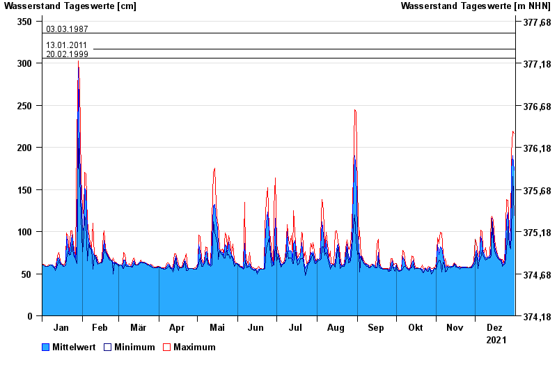
Chart of year Postmünster / Rott
Waterlevel from 01.01.2021 to 31.12.2021
- 02.08.1991 Wasserstand: 388 cm
- 03.06.2013 Wasserstand: 373 cm
- 03.03.1987 Wasserstand: 336 cm
- 13.01.2011 Wasserstand: 317 cm
- 20.02.1999 Wasserstand: 306 cm
| Date | Mean value [cm] | Maximum [cm] | Minimum [cm] |
|---|---|---|---|
| 31.12.2021 | 173 | 217 | 119 |
| 30.12.2021 | 190 | 219 | 165 |
| 29.12.2021 | 174 | 193 | 98 |
| 28.12.2021 | 82 | 98 | 79 |
| 27.12.2021 | 91 | 106 | 84 |
| 26.12.2021 | 122 | 137 | 106 |
| 25.12.2021 | 113 | 138 | 77 |
© Bayerisches Landesamt für Umwelt 2024