
- Start >
- Rivers >
- Waterlevel >
- Untere Donau >
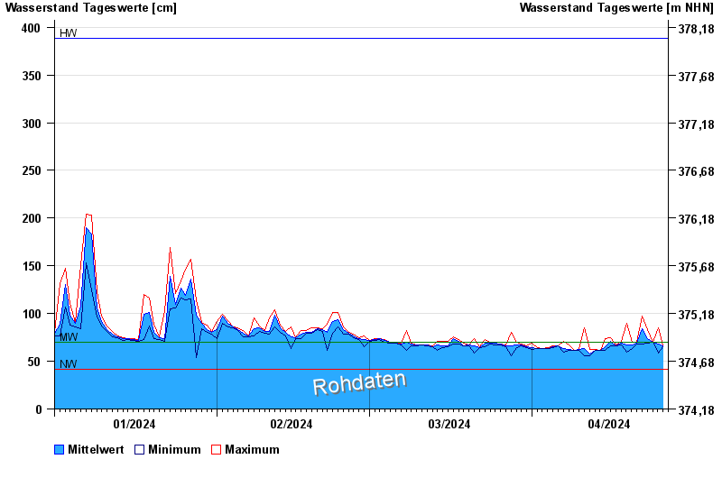
- Postmünster >
- Chart of year

Chart of year Postmünster / Rott
Waterlevel from 01.01.2024 to 26.04.2024
| Date | Mean value [cm] | Maximum [cm] | Minimum [cm] |
|---|---|---|---|
| 26.04.2024 | 65 | 66 | 65 |
| 25.04.2024 | 68 | 85 | 59 |
| 24.04.2024 | 70 | 70 | 70 |
| 23.04.2024 | 74 | 83 | 69 |
| 22.04.2024 | 84 | 97 | 68 |
| 21.04.2024 | 69 | 70 | 68 |
| 20.04.2024 | 67 | 70 | 63 |
© Bayerisches Landesamt für Umwelt 2024