
- Start >
- Rivers >
- Waterlevel >
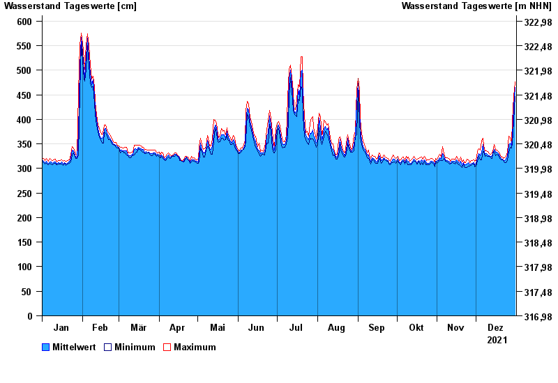
- Untere Donau >
- Pfatter >
- Chart of year

Chart of year Pfatter / Donau
Waterlevel from 01.01.2021 to 31.12.2021
- 04.06.2013 Wasserstand: 780 cm
- 27.03.1988 Wasserstand: 772 cm
- 14.08.2002 Wasserstand: 746 cm
- 22.12.1993 Wasserstand: 732 cm
- 25.02.1970 Wasserstand: 728 cm
| Date | Mean value [cm] | Maximum [cm] | Minimum [cm] |
|---|---|---|---|
| 31.12.2021 | 465 | 476 | 446 |
| 30.12.2021 | 425 | 446 | 396 |
| 29.12.2021 | 365 | 396 | 350 |
| 28.12.2021 | 347 | 353 | 342 |
| 27.12.2021 | 351 | 363 | 343 |
| 26.12.2021 | 348 | 366 | 333 |
| 25.12.2021 | 324 | 333 | 316 |
© Bayerisches Landesamt für Umwelt 2024