
- Start >
- Rivers >
- Waterlevel >
- Untere Donau >
- Pfatter >
- Chart of year

Chart of year Pfatter / Donau
Waterlevel from 01.01.2023 to 31.12.2023
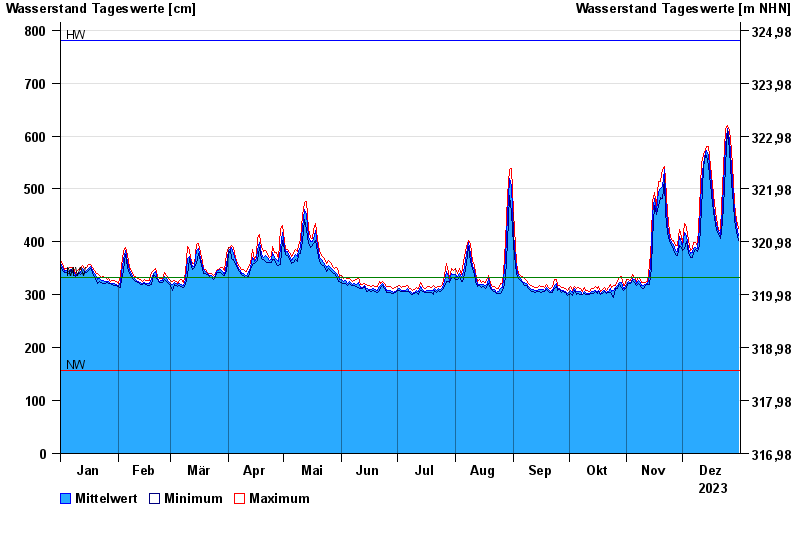
| Date | Mean value [cm] | Maximum [cm] | Minimum [cm] |
|---|---|---|---|
| 31.12.2023 | 412 | 425 | 402 |
| 30.12.2023 | 431 | 441 | 418 |
| 29.12.2023 | 454 | 470 | 441 |
| 28.12.2023 | 490 | 512 | 470 |
| 27.12.2023 | 540 | 572 | 512 |
| 26.12.2023 | 594 | 610 | 572 |
| 25.12.2023 | 615 | 619 | 610 |
© Bayerisches Landesamt für Umwelt 2024