
- Start >
- Rivers >
- Waterlevel >
- Untere Donau >
- Passau Ingling >
- Chart of year

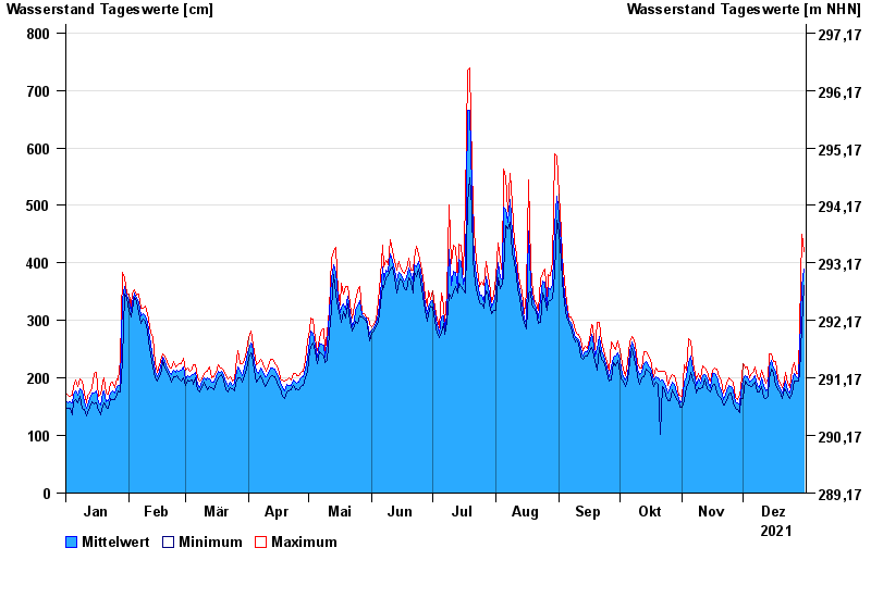
Chart of year Passau Ingling / Inn
Waterlevel from 01.01.2021 to 31.12.2021
Achtung
Dasa 1 ist zur Zeit def. und wird durch Dasa 2 ersetzt.
| Date | Mean value [cm] | Maximum [cm] | Minimum [cm] |
|---|---|---|---|
| 31.12.2021 | 390 | 420 | 361 |
| 30.12.2021 | 361 | 449 | 289 |
| 29.12.2021 | 248 | 289 | 206 |
| 28.12.2021 | 200 | 208 | 194 |
| 27.12.2021 | 203 | 208 | 195 |
| 26.12.2021 | 208 | 226 | 195 |
| 25.12.2021 | 194 | 215 | 173 |
© Bayerisches Landesamt für Umwelt 2025