
- Start >
- Rivers >
- Waterlevel >
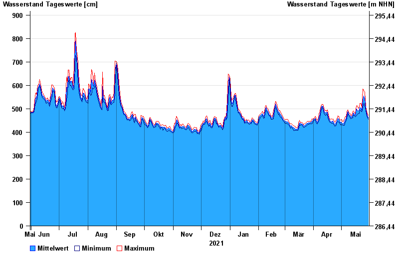
- Untere Donau >
- Passau >
- Chart of year

Chart of year Passau / Donau
Waterlevel from 31.05.2021 to 30.05.2022
| Date | Mean value [cm] | Maximum [cm] | Minimum [cm] |
|---|---|---|---|
| 30.05.2022 | 462 | 471 | 454 |
| 29.05.2022 | 470 | 479 | 463 |
| 28.05.2022 | 486 | 496 | 479 |
| 27.05.2022 | 501 | 510 | 494 |
| 26.05.2022 | 542 | 571 | 510 |
| 25.05.2022 | 554 | 576 | 525 |
| 24.05.2022 | 540 | 584 | 506 |
© Bayerisches Landesamt für Umwelt 2024