
- Start >
- Rivers >
- Waterlevel >
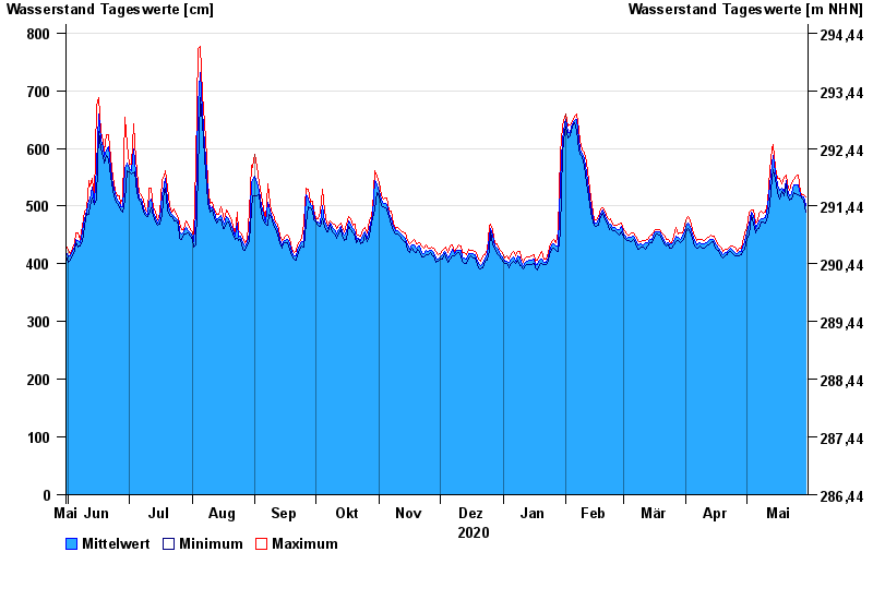
- Untere Donau >
- Passau >
- Chart of year

Chart of year Passau / Donau
Waterlevel from 31.05.2020 to 30.05.2021
- 03.06.2013 Wasserstand: 1289 cm
- 13.08.2002 Wasserstand: 1081 cm
- 22.03.2002 Wasserstand: 939 cm
- 21.07.1981 Wasserstand: 934 cm
- 04.08.1991 Wasserstand: 932 cm
| Date | Mean value [cm] | Maximum [cm] | Minimum [cm] |
|---|---|---|---|
| 30.05.2021 | 500 | 516 | 490 |
| 29.05.2021 | 516 | 519 | 511 |
| 28.05.2021 | 516 | 520 | 514 |
| 27.05.2021 | 520 | 525 | 517 |
| 26.05.2021 | 537 | 554 | 520 |
| 25.05.2021 | 537 | 552 | 522 |
| 24.05.2021 | 536 | 546 | 523 |
© Bayerisches Landesamt für Umwelt 2024