
- Start >
- Rivers >
- Waterlevel >
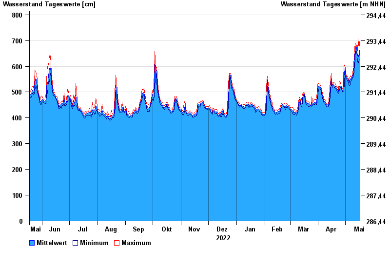
- Untere Donau >
- Passau >
- Chart of year

Chart of year Passau / Donau
Waterlevel from 18.05.2022 to 17.05.2023
- 03.06.2013 Wasserstand: 1289 cm
- 13.08.2002 Wasserstand: 1081 cm
- 22.03.2002 Wasserstand: 939 cm
- 21.07.1981 Wasserstand: 934 cm
- 04.08.1991 Wasserstand: 932 cm
| Date | Mean value [cm] | Maximum [cm] | Minimum [cm] |
|---|---|---|---|
| 17.05.2023 | 673 | 707 | 629 |
| 16.05.2023 | 632 | 667 | 625 |
| 15.05.2023 | 648 | 707 | 609 |
| 14.05.2023 | 640 | 659 | 619 |
| 13.05.2023 | 672 | 681 | 659 |
| 12.05.2023 | 676 | 688 | 660 |
| 11.05.2023 | 640 | 673 | 601 |
© Bayerisches Landesamt für Umwelt 2024