
- Start >
- Rivers >
- Waterlevel >
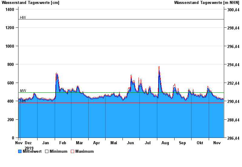
- Untere Donau >
- Passau >
- Chart of year

Chart of year Passau / Donau
Waterlevel from 28.11.2019 to 27.11.2020
| Date | Mean value [cm] | Maximum [cm] | Minimum [cm] |
|---|---|---|---|
| 27.11.2020 | 424 | 429 | 416 |
| 26.11.2020 | 423 | 427 | 419 |
| 25.11.2020 | 422 | 428 | 415 |
| 24.11.2020 | 424 | 432 | 416 |
| 23.11.2020 | 417 | 427 | 412 |
| 22.11.2020 | 420 | 431 | 412 |
| 21.11.2020 | 430 | 436 | 422 |
© Bayerisches Landesamt für Umwelt 2024