
- Start >
- Rivers >
- Waterlevel >
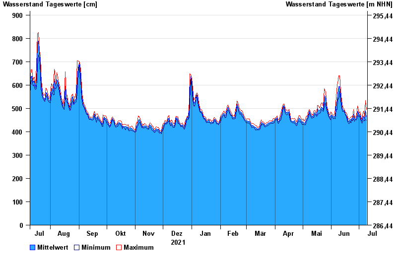
- Untere Donau >
- Passau >
- Chart of year

Chart of year Passau / Donau
Waterlevel from 10.07.2021 to 09.07.2022
- 03.06.2013 Wasserstand: 1289 cm
- 13.08.2002 Wasserstand: 1081 cm
- 22.03.2002 Wasserstand: 939 cm
- 21.07.1981 Wasserstand: 934 cm
- 04.08.1991 Wasserstand: 932 cm
| Date | Mean value [cm] | Maximum [cm] | Minimum [cm] |
|---|---|---|---|
| 09.07.2022 | 463 | 496 | 448 |
| 08.07.2022 | 488 | 533 | 452 |
| 07.07.2022 | 456 | 464 | 447 |
| 06.07.2022 | 462 | 490 | 450 |
| 05.07.2022 | 468 | 483 | 446 |
| 04.07.2022 | 444 | 450 | 435 |
| 03.07.2022 | 455 | 466 | 445 |
© Bayerisches Landesamt für Umwelt 2024