
- Start >
- Rivers >
- Waterlevel >
- Untere Donau >
- Oberndorf >
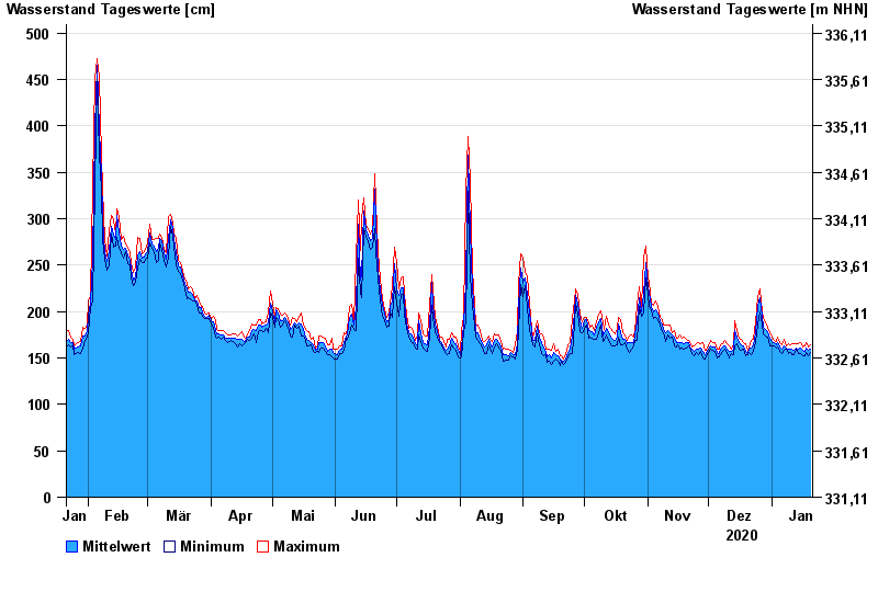
- Chart of year

Chart of year Oberndorf / Donau
Waterlevel from 21.01.2020 to 20.01.2021
- 24.05.1999 Wasserstand: 730 cm
- 04.06.2013 Wasserstand: 684 cm
- 26.08.2005 Wasserstand: 664 cm
- 16.04.1994 Wasserstand: 641 cm
- 14.08.2002 Wasserstand: 630 cm
| Date | Mean value [cm] | Maximum [cm] | Minimum [cm] |
|---|---|---|---|
| 20.01.2021 | 160 | 164 | 156 |
| 19.01.2021 | 158 | 162 | 152 |
| 18.01.2021 | 161 | 166 | 156 |
| 17.01.2021 | 157 | 163 | 152 |
| 16.01.2021 | 158 | 162 | 152 |
| 15.01.2021 | 161 | 166 | 155 |
| 14.01.2021 | 159 | 165 | 155 |
© Bayerisches Landesamt für Umwelt 2024