
- Start >
- Rivers >
- Waterlevel >
- Untere Donau >
- Neustift >
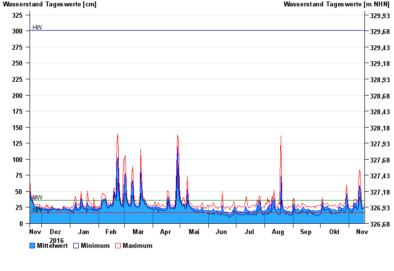
- Chart of year

Chart of year Neustift / Wolfach
Waterlevel from 18.11.2016 to 17.11.2017
| Date | Mean value [cm] | Maximum [cm] | Minimum [cm] |
|---|---|---|---|
| 17.11.2017 | 25 | 27 | 23 |
| 16.11.2017 | 26 | 30 | 23 |
| 15.11.2017 | 28 | 32 | 22 |
| 14.11.2017 | 34 | 40 | 30 |
| 13.11.2017 | 54 | 80 | 40 |
| 12.11.2017 | 59 | 84 | 40 |
| 11.11.2017 | 29 | 40 | 25 |
© Bayerisches Landesamt für Umwelt 2024