
- Start >
- Rivers >
- Waterlevel >
- Untere Donau >
- Münchshofen >
- Chart of year

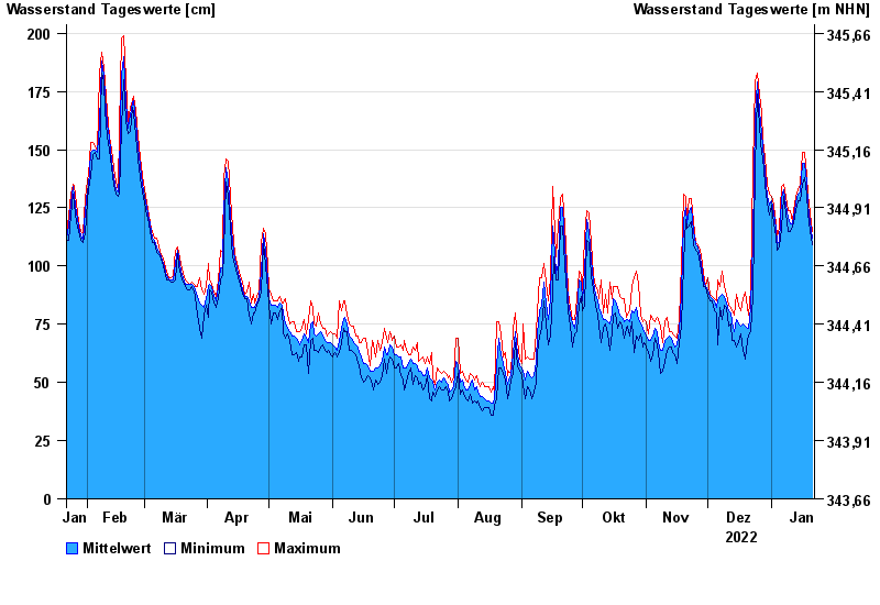
Chart of year Münchshofen / Naab
Waterlevel from 22.01.2022 to 21.01.2023
- 15.01.2011 Wasserstand: 396 cm
- 27.03.1988 Wasserstand: 387 cm
- 27.01.1995 Wasserstand: 385 cm
- 04.01.2003 Wasserstand: 381 cm
- 24.02.1970 Wasserstand: 363 cm
| Date | Mean value [cm] | Maximum [cm] | Minimum [cm] |
|---|---|---|---|
| 21.01.2023 | 112 | 115 | 109 |
| 20.01.2023 | 119 | 123 | 115 |
| 19.01.2023 | 126 | 131 | 123 |
| 18.01.2023 | 136 | 139 | 131 |
| 17.01.2023 | 144 | 149 | 138 |
| 16.01.2023 | 144 | 149 | 135 |
| 15.01.2023 | 132 | 135 | 128 |
© Bayerisches Landesamt für Umwelt 2024